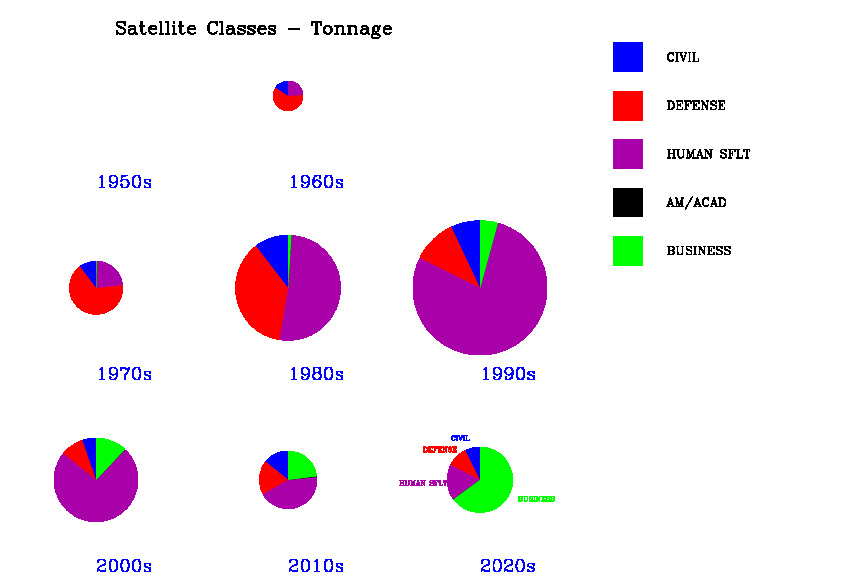
Here we show pie charts of various quantities summed over a decade at a time. Radius of the pie is proportional to the total quantity for that decade.
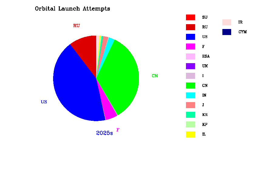
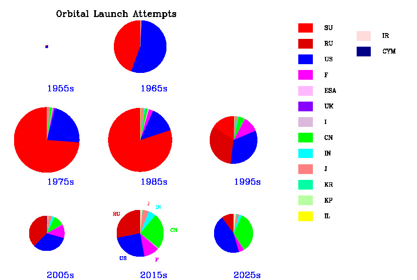
Decadal trends: orbital launch attempts by country
 |  |
| Data | |
| Orbital Launch Attempts: by country and decade. Size of circle indicates total launch rate. | |
 |  |
| Data | |
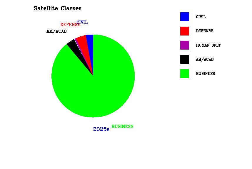
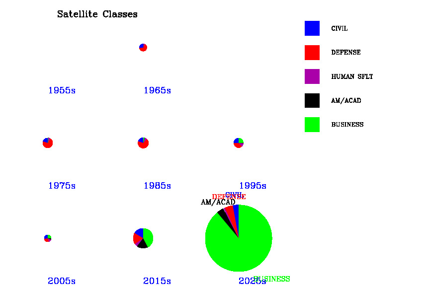
| Satellites launched by owner class and decade. Size of circle indicates total no of sats. | |
 |  |
| Data | |
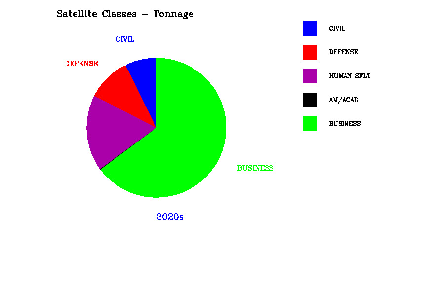
| Satellite tonnage launched by owner class and decade. Size of circle indicates total tonnage of sats. Mass includes that of Space Shuttle orbiters, explaining the large values in 1981-2011 | |
 |  |
| Data | |
| Satellites launched by mission category and decade. Size of circle indicates total no of sats. | |
 |  |
| Data | |
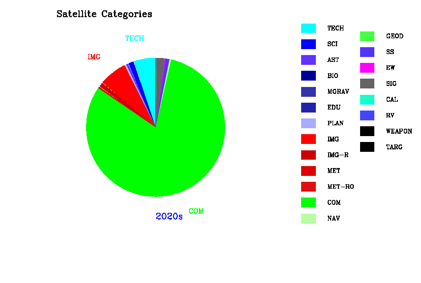
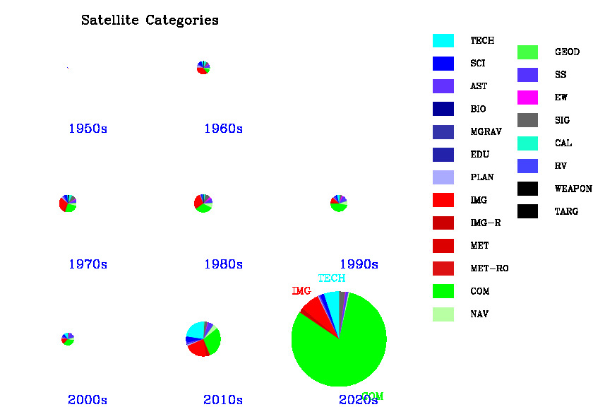
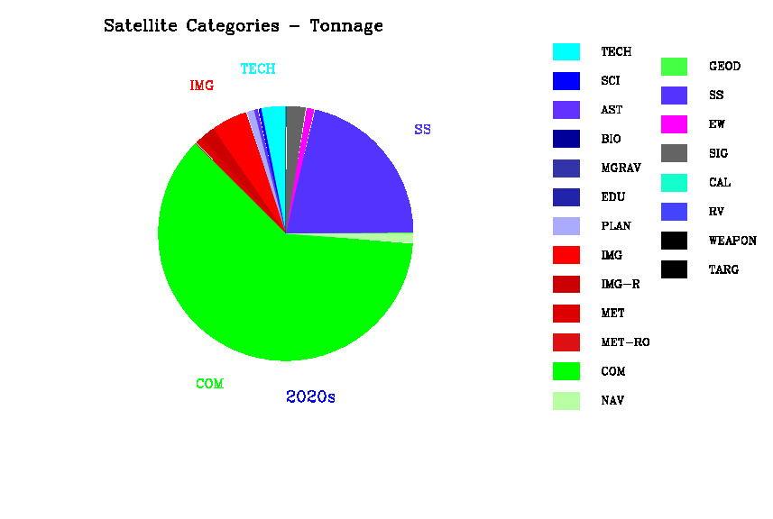
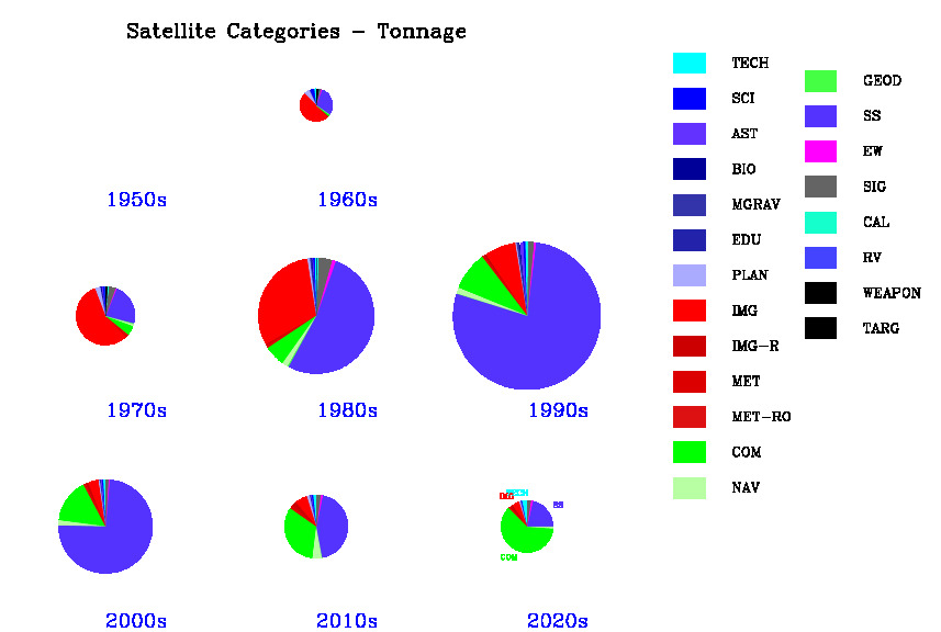
| Satellite tonnage launched by mission category and decade. Size of circle indicates total tonnage of sats | |
 |  |
| Data | |
| Satellites launched by owner region and decade. Size of circle indicates total no of sats. | |
 |  |
| Data | |
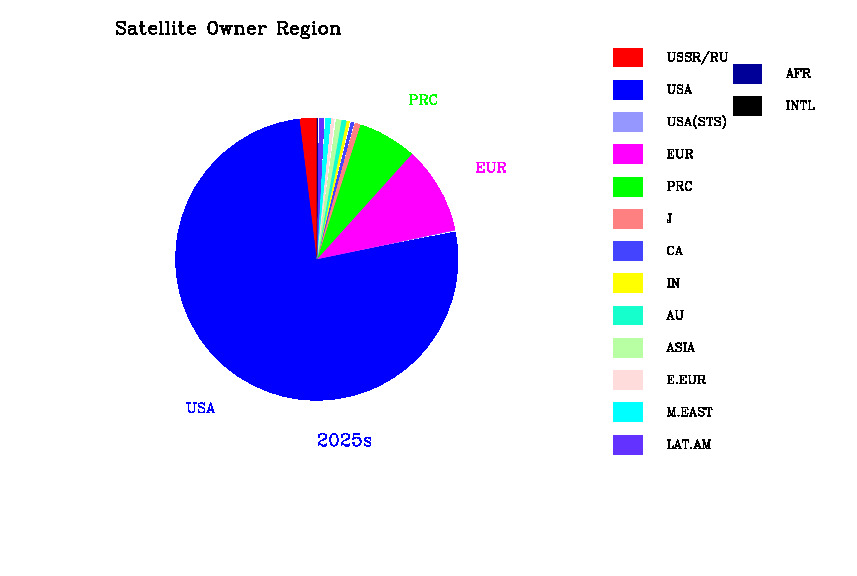
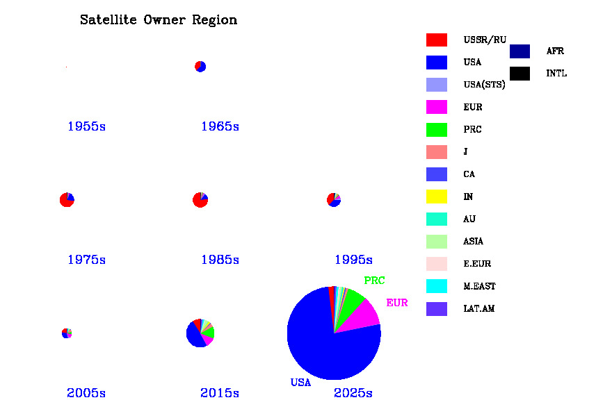
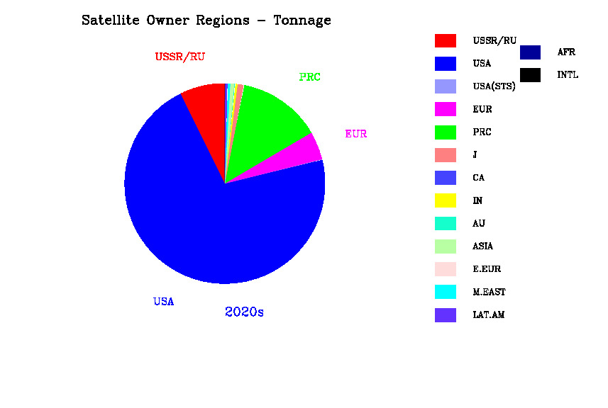
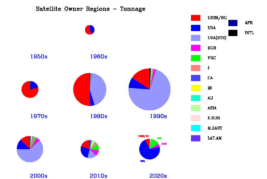
| Satellite tonnage launched by owner region and decade. Size of circle indicates total tonnage of sats | |
 |  |
| Data | |
| Satellites launched by manufacturer region and decade. Size of circle indicates total no of sats. | |
 |  |
| Data | |
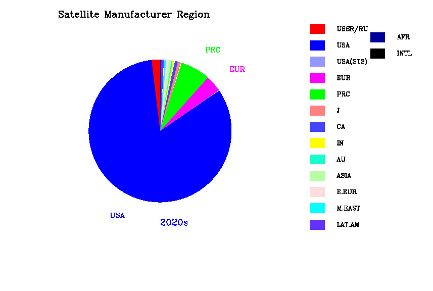
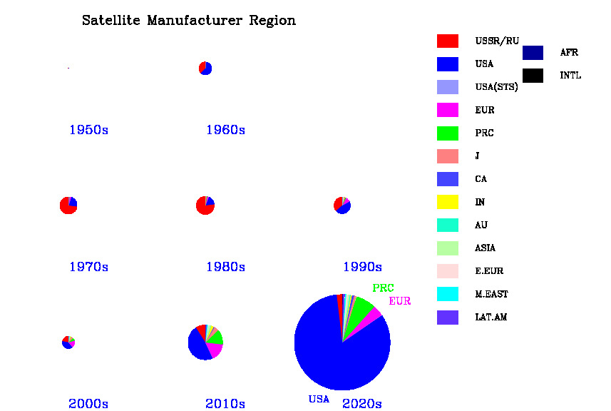
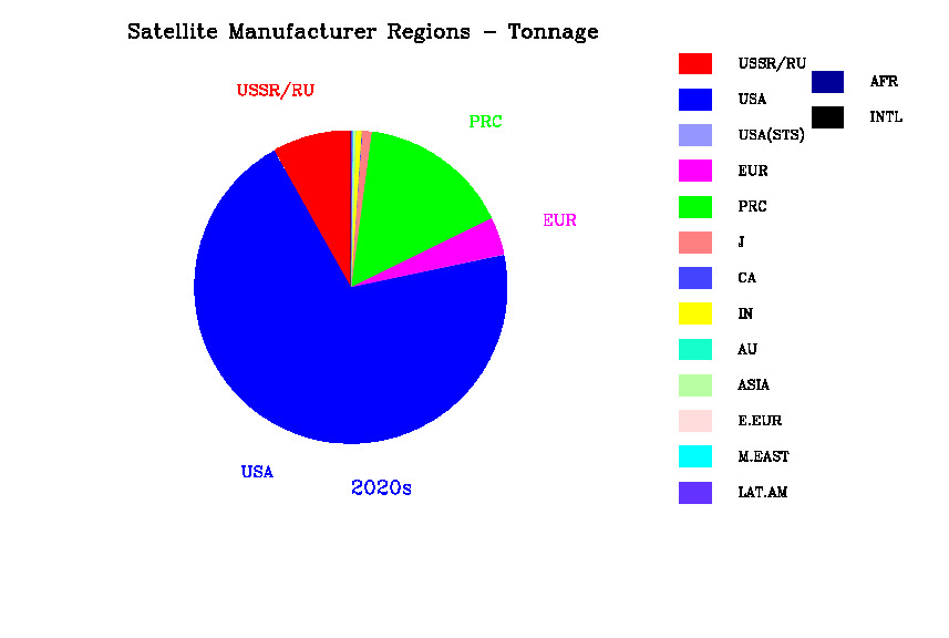
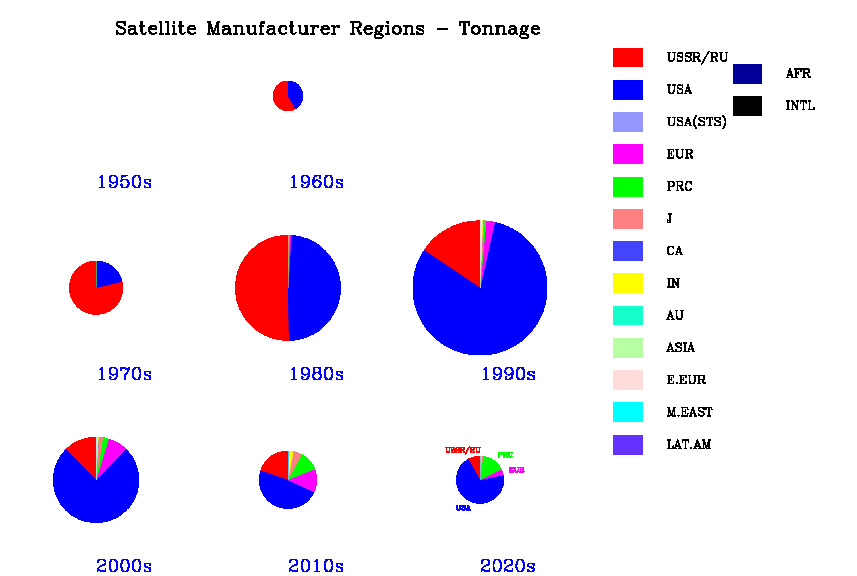
| Satellite tonnage launched by manufacturer region and decade. Size of circle indicates total tonnage of sats | |
Owner categories are
| A | Amateur/Academic (non-profit) |
| B | Business (commercial) |
| C | Civil (government agency, non defense) |
| D | Defense (government agency, defense or intelligence) |
| SS | Spaceship (government agency, human spaceflight |
as well as dual-use categories (C/D, C/B etc)
Mission categories are
| TECH | Test, Technology and component development |
| SCI | Scientific research, including astronomy, life and space sci |
| PLAN | Missions intended to leave Earth orbit |
| IMG | Earth imaging including weather |
| COM | Communications |
| NAV | Navigation, plus search-and-rescue |
| SS | Spaceships (human spaceflight related including cargo and station modules) |
| SIG | Signals intelligence |
| CAL | Passive calibration satellites |
| MIL | Space weapons |
Country/region abbreviations for launch vehicles are
| USSR | USSR and Russian Federation |
| USA | United States |
| UK | United Kingdom |
| F | France (including Arianespace) |
| PRC | People's Republic of China |
| J | Japan |
| EUR | Europe (ELDO/ESA but not Arianespace) |
| IN | India |
| BR | Brazil |
| IL | Israel |
| KR | South Korea |
| KP | North Korea |
| IR | Iran |
Country/region abbreviations for satellite owner/manufactures are
| USSR | USSR and Russian Federation |
| USA | United States |
| EUR | Western Europe (including UK, France, Italy, Germany, Netherlands, Spain, Sweden, Luxembourg, Portugal, Norway, Denmark, Greece, Switzerland, Austria, Belgium and European regional IGOs) |
| CA | Canada |
| INTL | International (Global IGOs including pre-privatized Inmarsat, Intelsat and Bermuda-based Intelsat Ltd) |
| J | Japan |
| AU | Australia |
| PRC | People's Republic of China |
| IN | India |
| ASIA | Rest of Asia excluding MidEast, India, China, Asian Russia and Japan but including Indonesia, Hong Kong, Korea, Thailand, Malaysia, Phillipines, Singapore, North and South Korea, Vietnam, Taiwan, Kazakhstan, Azerbaijan |
| M.EAST | Middle East including Saudi Arabia, Israel, Pakistan, Turkey, Egypt, UAE, Iran |
| LAT.AM | Latin America including Brazil, Mexico, Argentina, Chile, Colombia, Venezuela |
| E.EUR | Eastern Europe including Czechia, Ukraine, Belarus, Hungary, Poland, Romania |
| AFR | Africa excluding MidEast but including South Africa, Morocco, Algeria, Nigeria, Mauritius |